

The next of the Mount Merrion Historical Society‘s season of illustrated talks will take place on Thursday 3rd December in the Community Centre.
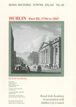
Irish Historic Towns Atlas,
Dublin III, 1756-1847 by Rob Goodbody
The talk will trace the history and development of Dublin through the late eighteenth and early nineteenth century when many of the city’s modern streets were laid out. A series of loose sheet maps present a variety of views that illustrate Dublin over the period. Colour maps depict the city in 1847 at two different scales, and these can be compared with a modern town plan of 2012.
8.00pm Thursday 3rd December
Mount Merrion Community Centre
Admission charges:
MMHS Members: No charge
Non members: €4.00 (Students €2.00)